The Garstin Trail
![]()
|
The Garstin Trail
|
|
Get Away for Less This Weekend with Hotwire!
Up to 70% OFF hotels in Palm Springs! Want to help us with this website? You can!! You help us with the costs of this website when you follow the Orbitz and Hotwire links to book your Airfare, Hotel and Rental Car!! So please book your Hotel and Airfare with Orbitz or Hotwire by following links above, and help us continue to maintain and improve this website. You can book airfare, hotels, and rental cars right here and help us at the same time!! Are you planning a hiking adventure in the Palm Springs area? The link below will take you to Amazon.com to enable you to purchase the Palm Springs area Hiking Bible, Philip Ferranti's 120 Great Hikes in and Near Palm Springs. I have my well used copy, and YOU should too!!
|
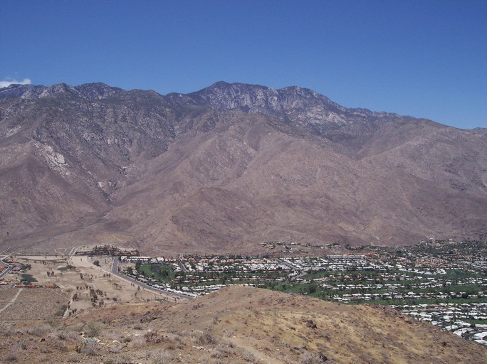
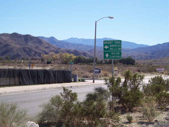
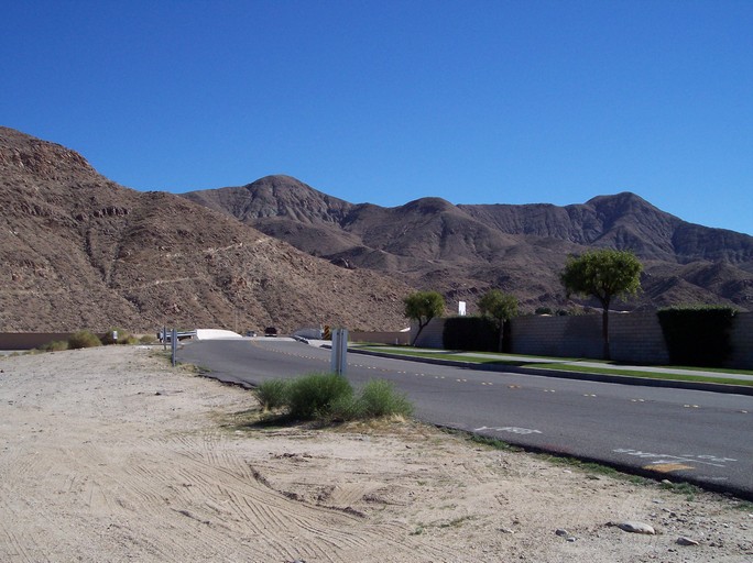
Mt. San Jacinto as seen from the Garstin Trail. Photo By : Gary R. Burzell Moderate to strenuous 2.0 miles (4 miles round-trip) Beginning Elevation 740' Elevation Gain 760' Round trip hiking time about 2 hours ( depending on how much you stop to enjoy the views . . ) The Garstin Trail immediately goes uphill, and winds up Smoke Tree Mountain with a series of switch backs. It rises to a plateau connecting with the Shannon, Berns, Wild Horse, and Eagle Canyon Trails. It offers magnificent panoramic views of the Canyon Country Club area, the San Jacinto and and Little San Bernardino Mountains, and Palm Canyon and Palm Springs. Once at the top you are also rewarded with great views of Cathedral City, and the eastern Coachella Valley. At the top of the Garstin Trail ( elevation 15,22 feet ), there is a trail junction that can connect you with the trails mentioned above, as well with the Wild Horse Trail which can be used to climb Murray Hill (elevation 2,210 feet ), the highest peak in the immediate area. The Murray Hill hike is strenuous, but well worth it. To get to Murray Hill, follow the Garstin to the junction of the Wild Horse Trail (the junction is shortly after you reach the plateau of Smoke Tree Mountain at the top of the Garstin...). Take the Wild Horse Trail and follow the trailheads that lead you to the Clara Burgess Trail. You will keep to the left when you reach the junction of the Wild Horse and the Fern Canyon Trail, and follow that trail up to the top of Murray Hill. It is a hard hike, but well worth it, as you are rewarded with fantastic views of the Coachella Valley from the top of Murray Hill. To get to the Garstin Trail, take Palm Canyon Drive South to Bogert Trail. Turn left on Bogert Trail and follow it to the bridge that crosses the wash. Park in the little street to the left just after the bridge. The trailhead is located at the end of that short street.
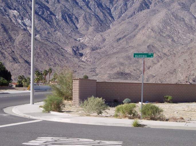
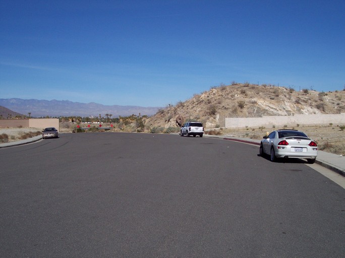
These photos should help you find the Garstin Trail trailhead. Drive up South Palm Canyon Drive until you get to Bogert Trail (first photo), turn left and follow until after you cross the small bridge (2nd photo), turn left unto Barona (third photo), and park along the street (4th photo). In the 2nd photo you can see the Garstin Trail winding up the hill.
For tips on how much WATER you need click above
Hiking Message Board If you find this hiking information useful, and would like to use PayPal to help us with the costs of this website, you can donate any amount you want ( $1, or $5, or maybe $56,000 -- err aah, ok that may be a bit much, however any amount you want to send helps a lot . . . ) just by clicking the logo above! Please note this is not necessary or expected, but any amount helps us keep improving this Website ! !

FastCounter by bCentral Website designed and
maintained By:
|